Joseph Mallord William Turner Scarborough; Flamborough Head; Robin Hood's Bay 1822
Image 1 of 2
Joseph Mallord William Turner,
Scarborough; Flamborough Head; Robin Hood's Bay
1822
Joseph Mallord William Turner 1775–1851
Folio 3 Verso:
Scarborough; Flamborough Head; Robin Hood’s Bay 1822
D17513
Turner Bequest CC 3a
Turner Bequest CC 3a
Pencil on white wove paper, 187 x 114 mm
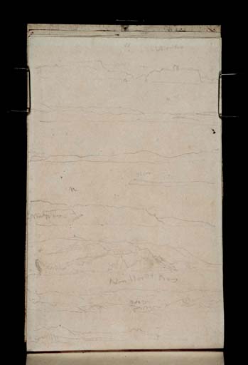
Inscribed in pencil by Turner, going down the page from left to right, ‘w’ ‘Scarbro’ | ‘NW’ | ?‘flam’ | ‘n’ | ?‘Flamborough’ [or ‘Mulgrave’] | ‘Robin Hoods Bay’ | ?‘Town’
Blindstamped with the with the Turner Bequest stamp bottom right
Inscribed in pencil by Turner, going down the page from left to right, ‘w’ ‘Scarbro’ | ‘NW’ | ?‘flam’ | ‘n’ | ?‘Flamborough’ [or ‘Mulgrave’] | ‘Robin Hoods Bay’ | ?‘Town’
Blindstamped with the with the Turner Bequest stamp bottom right
Accepted by the nation as part of the Turner Bequest 1856
Exhibition history
1857
Marlborough House, London, and other venues, 1857–8 (235 [NG no.438c] probably the verso of this page: Tate D17514; Turner Bequest CC 3a).
References
1909
A.J. Finberg, A Complete Inventory of the Drawings of the Turner Bequest, London 1909, vol.I, p.610, CC 3a, as ‘“Scarborough,” “Flamborough Head,” “Robin Hood’s Bay.” Reverse of 438c, N.G.’.
1961
Alexander J. Finberg, The Life of J.M.W. Turner, R.A. Second Edition, Revised, with a Supplement, by Hilda F. Finberg, revised ed., Oxford 1961, p.277.
1981
Gerald Finley, Turner and George the Fourth in Edinburgh 1822, exhibition catalogue, Tate Gallery, London 1981, pp.81, [94] reproduced as ‘“Scarborough”, “Flamborough Head”, “Robin Hood’s Bay”. Reverse of Nat Gallery 438c (see p.3 above)’.
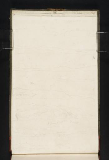
Continuing up the east coast of Britain in a boat bound for Edinburgh (see folio 1 verso for details; D17509), this page contains sketches covering the area between Flamborough Head and Robin Hood’s Bay. The sketchbook page was used turned to the right.
The top sketch, labelled ‘Scarborough’, shows the town from near the south bay area, and looks west according to Turner’s ‘w’ inscription. The area between the two cliffs is the old harbour, and the remains of the keep of Scarborough Castle are shown at the top of the cliff to the right.
The second and third sketch down (bearing in mind the inscriptions for the fourth and fifth sketches and the sequence of views) probably shows the coastline between Flamborough Head and Scarborough. According to the inscription, ‘NW’, the views are looking north-west. The fourth sketch, labelled ‘Flam’, shows the headland of Flamborough Head from the north.
Sketches five and six probably show ‘Flamborough’ Head looking north (‘N’) from the south (although the inscription could read ‘Musgrave’ and therefore show another part of the Yorkshire Coast as in folio 88; D17664). The lower of the two sketches is from closer to, so the cliffs are seen in greater detail and the lighthouse is now visible. Incidentally, when the Royal George passed Flamborough Head a few days later the cliff tops were apparently crowded with people waving to King George IV.1
The second-to-bottom sketch is labelled ‘Robin Hoods Bay’ and shows the North Yorkshire town nestled between hills. The town itself sits on the cliffs just above the bay, and is indicated in the sketch by a series of squares and may be inscribed ‘town’.
Technical notes:
The page is slightly yellowed owing to light exposure (as on the recto; D17512), and has been reattached to the sketchbook. It was removed by Ruskin to exhibit in the National Gallery Touring exhibition.
The page is slightly yellowed owing to light exposure (as on the recto; D17512), and has been reattached to the sketchbook. It was removed by Ruskin to exhibit in the National Gallery Touring exhibition.
Thomas Ardill
July 2008
How to cite
Thomas Ardill, ‘Scarborough; Flamborough Head; Robin Hood’s Bay 1822 by Joseph Mallord William Turner’, catalogue entry, July 2008, in David Blayney Brown (ed.), J.M.W. Turner: Sketchbooks, Drawings and Watercolours, Tate Research Publication, December 2012, https://www


