J.M.W. Turner
>
1830-35 Annual tourist
>
Scotland 1831
>
Inverness Sketchbook
>
Artwork
Joseph Mallord William Turner Sketches Made on the Black Isle 1831
Image 1 of 2
Joseph Mallord William Turner,
Sketches Made on the Black Isle
1831
Joseph Mallord William Turner 1775–1851
Folio 10 Verso:
Sketches Made on the Black Isle 1831
D27063
Turner Bequest CCLXXVII 10a
Turner Bequest CCLXXVII 10a
Pencil on off-white wove paper, 104 x 163 mm
Inscribed in pencil by Turner ‘M[...] vale’ centre inverted, ?‘Kin Kel’ lower centre inverted
Inscribed in pencil by Turner ‘M[...] vale’ centre inverted, ?‘Kin Kel’ lower centre inverted
Accepted by the nation as part of the Turner Bequest 1856
References
1909
A.J. Finberg, A Complete Inventory of the Drawings of the Turner Bequest, London 1909, vol.II, p.883, CCLXXVII 10a, as ‘Loch, with mountains.’.
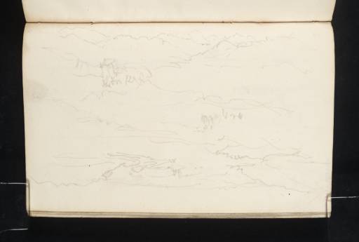
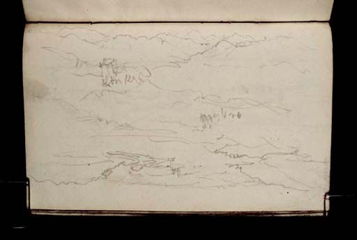
The three sketches on this page are all extremely rough, and although they are labelled by Turner, his handwriting is illegible. However, David Wallace-Hadrill and Janet Carolan have made suggestions for possible identifications of views on the Black Isle, the peninsula between the Moray Firth and Cromarty Firth.1 These are consistent with the route Turner is likely to have taken from Inverness to Evanton, where he visited Hugh Munro at Novar House.
At the top of the page (towards the fore-edge) is a view towards a river (or canal) with a hill to the right. This, Wallace-Hadrill suggests, may be a view south from the Black Isle (presumably at North Kessock) towards the mouth of the Caledonian Canal at Clachnaharry. The serpentine curve of the canal at the right matches the shape of the Caledonian Canal, and the shape of the hill is just right for Craig Phadrig to the west of Inverness. There is even, at the left of the sketch, the suggestion of another curved body of water, which could be the mouth of the River Ness at Inverness.
The other two sketches were drawn with the page inverted. At the centre is a sketch that Wallace-Hadrill interpreted as a hill peak seen from across a body of water. The sketch is inscribed with what he has read as a reference to Mountgerald, a village on the northern side of the Cromarty Firth, making this a view across the firth from the Black Isle. To the present author, however, the inscription appears to refer to a ‘vale’ and the peak appears to be too high to be a view towards Mountgerald.
The authors’ suggestion for the inscription of the sketch at the bottom of the page, ‘Kinkell’, is more convincing. Their suggestion that this is a view west up Strathconon with Kinkell Castle is also a plausible match for this sketch, and one that is consistent with Turner’s probable route to Evanton via Conon Bridge (about a mile north of the castle) and Dingwall. There is apparently a legend that Prince Charles Edward Stuart hid in the castle for a time in 1745,2 which may account for Turner’s interest in the small tower house. There is a more carefully executed sketch of the same castle on folio 11 (D27064).
Thomas Ardill
April 2010
David Wallace-Hadrill and Janet Carolan, ‘Sketchbook CCLXXVII Inverness’, [circa 1991], Tate catalogue files, [unpaginated].
‘Kinkell Castle’, Gazetteer for Scotland, accessed 30 April 2010, http://www.geo.ed.ac.uk/scotgaz/features/featurefirst17338.html .
How to cite
Thomas Ardill, ‘Sketches Made on the Black Isle 1831 by Joseph Mallord William Turner’, catalogue entry, April 2010, in David Blayney Brown (ed.), J.M.W. Turner: Sketchbooks, Drawings and Watercolours, Tate Research Publication, December 2012, https://www


