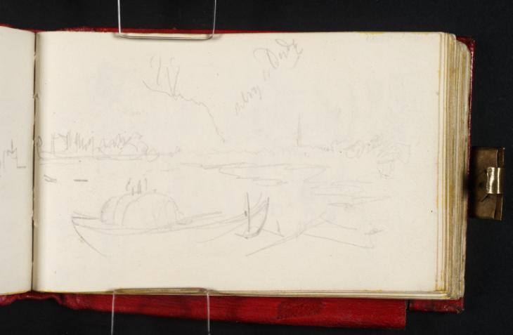
Joseph Mallord William Turner The Banks of the River Thames, Probably at Barnes; ?a Midlands Sketch Map c.1827-30
Image 1 of 2
Joseph Mallord William Turner,
The Banks of the River Thames, Probably at Barnes; ?a Midlands Sketch Map
c.1827-30
Joseph Mallord William Turner 1775–1851
Folio 58 Verso:
The Banks of the River Thames, Probably at Barnes; ?a Midlands Sketch Map c.1827–30
D22434
Turner Bequest CCXL 58a
Turner Bequest CCXL 58a
Pencil on white wove paper, 68 x 110 mm
Inscribed by Turner in pencil ‘[...] to [?Dudy]’ top centre, ascending diagonally
Inscribed by Turner in pencil ‘[...] to [?Dudy]’ top centre, ascending diagonally
Accepted by the nation as part of the Turner Bequest 1856
References
1909
A.J. Finberg, A Complete Inventory of the Drawings of the Turner Bequest, London 1909, vol.II, p.740, CCXL 58a, as ‘River scene’.
Turner’s inscription at the top, beside a cluster of lines which are possibly the beginnings of a sketch map, may indicate a route from somewhere else on Turner’s 1830 Midlands tour to Dudley, apparently given in abbreviated form as ‘Dudy’. The town is the subject of many drawings in this sketchbook, probably including the one on the recto (D22433); see under folio 39 recto (D22395) for others.
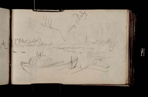
This rapid riverside sketch with a boat in the foreground was presumably made on the same occasion and in the vicinity of identifiable views from the south bank of the Barnes reach of the River Thames, up-river of central London. There are various views of the bridges at Hammersmith and Putney and the river between them on subsequent pages (together with riverside studies of boats and figures) as far as folio 71 verso (D22460). The figure groups inside the back cover (D41057) are possibly related. As this and most of the riverside studies are inverted relative to the sketchbook’s foliation, Turner may have worked inwards from the cover to this point.
The suspension bridge between Hammersmith (on the north bank) and Barnes was begun in 1825 and opened in October 1827, its chains and roadway supported by two massive stone Tuscan arches. It was replaced in the 1880s by the present bridge, supported by iron towers resting on the original piers.1 Turner’s admittedly rather slight views of the bridge seem to have a rather provisional air; the chains and roadway are not indicated clearly, and it was possibly still under construction. As the sketchbook is watermarked 1827, the year when the bridge opened, this date is suggested here for the riverside sequence, as opposed to the firm date of 1830 for the extensive Midlands subjects elsewhere in the book (see the introduction). In addition to Turner’s general inclination for Thames subjects,2 he may have taken a particular interest in the bridge’s progress, having lived at Hammersmith between 1806 and 1811.3
As shown in the Hammersmith and Barnes section of Clark’s panoramic aquatint survey of the Thames, produced around 1829 (London Metropolitan Archives), the Hammersmith side was already largely lined with low buildings, some of which appear to survive today, while the Barnes bank was wooded, as it remains. Downstream and south-east of Hammersmith and Barnes lie Putney on the south bank and Fulham on the north; this sequence also includes views of the wooden Old Putney Bridge, built in the 1720s and replaced in the 1880s,4 flanked in the distance by the square towers of All Saint’s Church, Fulham and St Mary’s, Putney. As shown by various images in the London Metropolitan Archives, both then had the shallow spires and tall weathervanes evident in these sketches. All Saints is now hidden by trees, and St Mary’s is hemmed in by latter buildings including a tower block just to its east. Turner does not seem to have represented either bridge elsewhere, except possibly the one at Putney in a watercolour of 1811 and an associated Liber Studiorum design, as discussed elsewhere in the present catalogue (see under Tate N02782).
Matthew Imms
August 2013
See ‘Hammersmith Bridge’, Where Thames Smooth Waters Glide, accessed 22 July 2013, http://thames.me.uk/s00240.htm .
See James Hamilton, ‘Hammersmith’ in Evelyn Joll, Martin Butlin and Luke Herrmann (eds.), The Oxford Companion to J.M.W. Turner, Oxford 2001, p.135, mentioning the Hammersmith studies in this sketchbook in general.
See ‘Putney Bridge’, Where Thames Smooth Waters Glide, accessed 25 July 2013, http://thames.me.uk/s00230.htm .
How to cite
Matthew Imms, ‘The Banks of the River Thames, Probably at Barnes; ?a Midlands Sketch Map c.1827–30 by Joseph Mallord William Turner’, catalogue entry, August 2013, in David Blayney Brown (ed.), J.M.W. Turner: Sketchbooks, Drawings and Watercolours, Tate Research Publication, September 2014, https://www


