Joseph Mallord William Turner ?Peak District Hills or a Cave, Perhaps Peak Cavern, Castleton; Sketch Map of the Peak District ?1831
Image 1 of 2
Joseph Mallord William Turner,
?Peak District Hills or a Cave, Perhaps Peak Cavern, Castleton; Sketch Map of the Peak District
?1831
Joseph Mallord William Turner 1775–1851
Folio 21 Recto:
?Peak District Hills or a Cave, Perhaps Peak Cavern, Castleton; Sketch Map of the Peak District ?1831
D22187
Turner Bequest CCXXXIX 21
Turner Bequest CCXXXIX 21
Pencil on white wove paper, 114 x 191 mm
Partial watermark ‘R Ba | 18’
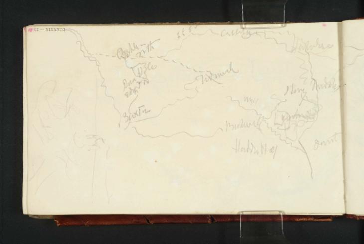
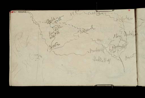
Inscribed by Turner in pencil ‘Chapel [...] | Frith’, ‘Castleton’, ‘Hathersage’, ‘Dove Hole’, ‘Edge [?Tor]’, ‘Tideswell’, ‘Wye’, ‘Stoney Middleton’, ‘Buxton’, ‘Bakewell’, ‘Chatsworth’, ‘Haddon Hall’ and ‘Derwent’ at corresponding points on map
Inscribed by John Ruskin in red ink ‘21’ top left, upside down
Stamped in black ‘CCXXXIX – 21’ top left, upside down
Accepted by the nation as part of the Turner Bequest 1856
References
1909
A.J. Finberg, A Complete Inventory of the Drawings of the Turner Bequest, London 1909, vol.II, p.734, CCXXXIX 21, as ‘Slight sketch; also sketch map showing the relative positions of the following places– | “Chapel-le-Frith. Castleton. Hathersage. Sheffield. Dove Hole. | Edge Tor. Tideswell. Stoney Middleton. Burton. Bakewell. Haddon Hall.”’.
1981
Luke Herrmann, ‘Reviews: Books: Collected Correspondence of J.M.W. Turner’, Turner Studies, vol.1, no.2, Winter 1981, p.47, dating present sketchbook to 1830.
1987
John Gage, J.M.W. Turner: ‘A Wonderful Range of Mind’, New Haven and London 1987, p.246 note 8.
At the outer edge, with the page turned vertically, is a slight sketch of looping or undulating forms, possibly indicating a cave such as the Peak Cavern below Peveril Castle at Castleton (seen on adjacent pages), for which see under folio 1 verso (D22152). Inverted relative to the sketchbook’s foliation, the sketch map occupying most of the page focuses on an area roughly fifteen miles across and twelve from north to south in the middle of the Peak District. Sheffield is indicated to the north-east in a slight continuation on folio 20 verso opposite (D22186).
Finberg (died 1939) correctly amended his earlier reading ‘Burton’ as ‘?Buxton’ in undated manuscript notes in a copy of his 1909 Inventory,1 and also observed ‘Hathersage is where Holworthy lived’.2 In his subsequent Life of Turner, he incorrectly assumed that Turner had used this sketchbook around Castleton and the Derbyshire part of the Peak District in the summer of 1830 – see the Introduction to the present sketchbook, and the ‘Midlands 1830’ section of this catalogue, comprising the Kenilworth and Birmingham and Coventry sketchbooks (Tate; Turner Bequest CCXXXVIII, CCXL). Finberg quoted Turner’s letter of 7 November 1830 to his artist friend James Holworthy (1781–1841) at Brookfield Manor, about a mile north of Hathersage, below the moors south-west of Sheffield and some five miles east of Castleton: ‘I could not get as far north as your worship’s residence.’3 This would be rather disingenuous of Turner had he been so close in 1830, but the most northerly identified subject sketched that year, Ashby-de-la-Zouch, Leicestershire, lies just outside Derbyshire, some forty miles south of Hathersage as the crow flies, making his excuse for being ‘delinquent with [Holworthy’s] invitations’4 understandable on that occasion.
Matthew Imms
April 2014
A.J. Finberg, undated MS notes in a copy of Finberg 1909, Tate Britain Prints and Drawings Room, vol.II, p.734.
How to cite
Matthew Imms, ‘?Peak District Hills or a Cave, Perhaps Peak Cavern, Castleton; Sketch Map of the Peak District ?1831 by Joseph Mallord William Turner’, catalogue entry, April 2014, in David Blayney Brown (ed.), J.M.W. Turner: Sketchbooks, Drawings and Watercolours, Tate Research Publication, September 2014, https://www


