Joseph Mallord William Turner Coastal Views of France and Kent c.1821-2
Image 1 of 2
Joseph Mallord William Turner,
Coastal Views of France and Kent
c.1821-2
Joseph Mallord William Turner 1775–1851
Folio 77 Verso:
Coastal Views of France and Kent c.1821–2
D17338
Turner Bequest CXCVIII 77a
Turner Bequest CXCVIII 77a
Pencil on white wove paper, 187 x 113 mm
Partial watermark ‘T Edm | 18’
Inscribed by Turner in pencil ‘[?Gontat]’ towards top centre
Partial watermark ‘T Edm | 18’
Inscribed by Turner in pencil ‘[?Gontat]’ towards top centre
Accepted by the nation as part of the Turner Bequest 1856
References
1909
A.J. Finberg, A Complete Inventory of the Drawings of the Turner Bequest, London 1909, vol.I, p.606, CXCVIII 77a, as ‘Several views of coast, from the Channel. “Gontat” (?)’.
Turner uses this page to transcribe four illustrations from The Little Sea Torch, an illustrated maritime text by Richard Bougard, translated from the French by J.T. Serres and published in London in 1801.1 For more detailed information about the publication, and an interrogation of Turner’s use of it, see the Introduction to this sketchbook. For a comprehensive list of the other pages used for the same purpose, see the entry for folio 55 recto (D17296).
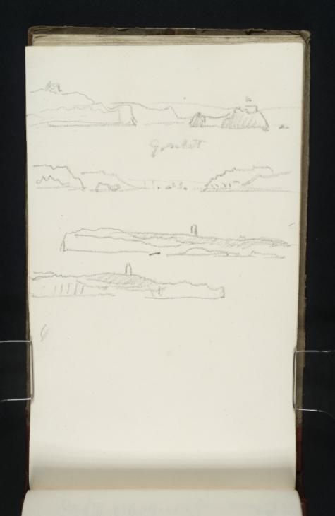
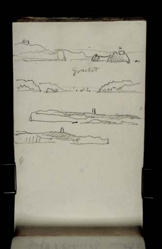
Finberg’s identification of ‘Several views of coast, from the Channel’ is correct, and adequately summarises the viewpoints adopted in each of the sketches.2 Made with the page turned vertically, the first drawing at the top of the sheet takes as its subject an engraving from plate 2 of The Little Sea Torch, entitled ‘Bertheaume Castle, bearing E.N.E with a Frigate lying in the Road.’3 Fort de Bertheaume is one of a series of coastal defences designed to protect the entrance to Brest harbour in Brittany in northwestern France.4 It sits atop a small island 100 metres from the shore. Here Turner fastidiously transcribes part of the original composition, including the mainland on the left and the island with castle and French flag blowing in the wind towards the left. In a demonstration of the dark hue applied to the engraving in the printed source, Turner shades the rocky outcrops with broad, hatched lines. He omits the Frigate warship which is on the far right in the original picture.
Further down the page, beneath an unfortunately ambiguous inscription, is a second coastal view taken from plate 2 of The Little Sea Torch. The original is the ninth engraving on that page, directly beneath the illustration of Fort de Bertheaume, and is described as ‘The Entrance of Brest Harbour E.½ S.’5 Turner copies the full scope of this image, from Le Grand Minou at far left (labelled in the original text ‘Pt. de Grand Menou’), to Le Petit Minou towards the centre on the left (labelled ‘Pettit Menou’ in the original source), and finishing at Camaret-sur-Mer on the right (‘Pt. de Cameret’ in the printed book). Turner only briefly indicates a row of battleships stretched across the water in between the two headlands, which are elaborated to a much greater degree in the engraving.
The final two drawings on this page return to a Kentish theme and have been extracted from plate 3 of The Little Sea Torch. The penultimate image is of ‘The North Foreland’.6 The first engraving on the printed plate, this prospect describes the chalk cliffs on the Kent coast complete with a silhouette of the lighthouse stationed on the headland. Turner made studies of this landmark from life, which can be found in the Studies near Brighton Sketchbook (Tate D00770; Turner Bequest XXX 35), and the Gravesend and Margate Sketchbook (Tate D27328, D27329; Turner Bequest CCLXXIX 33a, 34).In the present drawing, he diligently recreates the deviations in tone applied to the printed engraving, indicating turf using hatched strokes of his pencil, and leaving the white face of the cliffs blank.
Finally, the last drawing on the page describes a view of South Foreland taken from The Little Sea Torch.7 Turner describes the undulating coastline and stark white cliffs exactly as they appear in the engraving, although he omits any indication of the sea. The South Foreland lighthouse is clearly described on the horizon; this landmark and the surrounding topography are the subject of several drawings in the present sketchbook. For a list of pages which describe the landscape and lighthouse, see the entry for folio 8 recto (D17220).
On the far left, beneath the drawing of South Foreland, two short, curved pencil lines mark the edge of the page.
Maud Whatley
January 2016
Richard Bougard, The Little Sea Torch: or, True Guide for Coasting Pilots: by which they are clearly instructed how to navigate along the coasts of Malta, Corsica, Sardinia, and others in the Straits; and of The Coast of Barbary, from Cape Bon to Cape de Verd, trans. with corrections and additions by John Thomas Serres, London 1801. For an online and PDF facsimile, see ‘The Little Sea Torch’, accessed 26 October 2015, Biblioteca Nacional de Portugal, http://purl.pt/23500 .
Plate 2, The Little Sea Torch, accessed 18 November 2015, http://purl.pt/23500/1/index.html#/153/html .
‘Fort de Bertheaume’, Fortified Places, accessed 18 November 2015, http://www.fortified-places.com/bertheaume .
‘Plate 3’, The Little Sea Torch, accessed 18 November 2015, http://purl.pt/23500/1/index.html#/155/html .
How to cite
Maud Whatley, ‘Coastal Views of France and Kent c.1821–2 by Joseph Mallord William Turner’, catalogue entry, January 2016, in David Blayney Brown (ed.), J.M.W. Turner: Sketchbooks, Drawings and Watercolours, Tate Research Publication, February 2017, https://www


