J.M.W. Turner: Sketchbooks, Drawings and Watercolours

ISBN 978-1-84976-386-8

Joseph Mallord William Turner The Bridge at Le Pont-de-Beauvoisin 1819

Joseph Mallord William Turner 1775–1851
Folio 59 Verso:
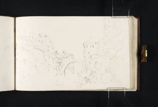
The Bridge at Le Pont-de-Beauvoisin 1819
D14085
Turner Bequest CLXXIII 59 a
Pencil on white wove paper, 114 x 185 mm
 
Accepted by the nation as part of the Turner Bequest 1856
The subject of this sketch is the town of Le Pont-de-Beauvoisin which lies on the River Guiers, approximately twenty miles west of Chambéry. The location forms part of the border between Isère and Savoy, and indeed the town is actually divided into two separate settlements, both sharing the same name but situated respectively on the south and north banks of the river. Since 1815 Savoy had been part of the Italian Kingdom of Piedmont-Sardinia and consequently the nineteenth-century traveller crossing the border from France was obliged to present their luggage for inspection at custom houses in both places.1
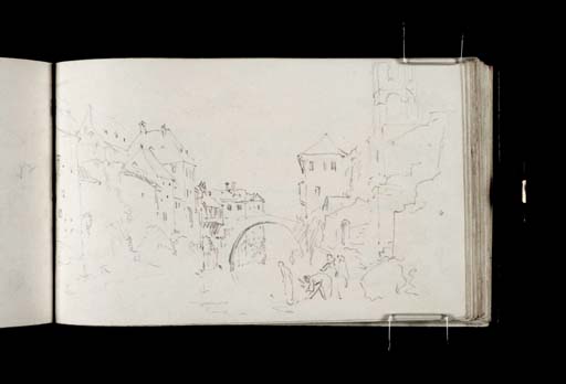
The focus of this view is the single-arched bridge from which Le Pont-de-Beauvoisin derives its name. Turner’s viewpoint looks north-west from the Savoy side of the river, standing beneath the Carmelite church (Église des Carmes), part of which is visible in the top right-hand corner. Further drawings relating to Le Pont-de-Beauvoisin can be found on folios 56, 57 and 60 verso (D14078, D14080 and D14087). The town also features within the Return from Italy sketchbook (see Tate D16705; Turner Bequest CXCII 33).

Nicola Moorby
March 2013

1
Heinrich August O. Reichard, A Descriptive Road Book of France, London 1829, p.305.

How to cite

Nicola Moorby, ‘The Bridge at Le Pont-de-Beauvoisin 1819 by Joseph Mallord William Turner’, catalogue entry, March 2013, in David Blayney Brown (ed.), J.M.W. Turner: Sketchbooks, Drawings and Watercolours, Tate Research Publication, August 2013, https://www.tate.org.uk/art/research-publications/jmw-turner/joseph-mallord-william-turner-the-bridge-at-le-pont-de-beauvoisin-r1142944, accessed 26 April 2024.