J.M.W. Turner: Sketchbooks, Drawings and Watercolours

ISBN 978-1-84976-386-8

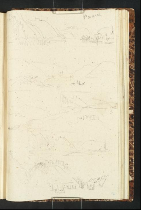
Joseph Mallord William Turner The Moselle Valley between the Marienburg and Montroyal 1839

Joseph Mallord William Turner 1775–1851
Folio 17 Verso:
The Moselle Valley between the Marienburg and Montroyal 1839
D28384
Turner Bequest CCXC 17 a
Pencil on flecked off-white wove paper, 163 x 100 mm
Inscribed in pencil by Turner ‘Ponrich’ (inverted) bottom left
 
Accepted by the nation as part of the Turner Bequest 1856
These rough and swiftly wrought sketches depict the stretch of the Mosel running between the Marienburg at Zell and the ruined fortress of Montroyal at Traben-Trarbach. With the sketchbook orientated in accordance with the foliation and at top left, Turner has drawn the Marienburg and again, inversely, directly below it. For other sketches of the Marienburg in this book see Tate D28378–D28380; Turner Bequest CCXC 14a–15a. See also the First Mossel and Oxford sketchbook of the 1839 tour (Tate D28299; Turner Bequest CCLXXXIX 5).
The remaining sketches are drawn with the sketchbook turned upside down and depict the Moselle Valley landscape at various locations. These all continue onto the folio opposite (Tate D28385; Turner Bequest CCXC 18). Two of the compositions have been partially squared off. The sketch annotated ‘Ponrich’ likely depicts the town of Pünderich which lies north of Traben-Trarbach on the Moselle.

Alice Rylance-Watson
July 2013

How to cite

Alice Rylance-Watson, ‘The Moselle Valley between the Marienburg and Montroyal 1839 by Joseph Mallord William Turner’, catalogue entry, July 2013, in David Blayney Brown (ed.), J.M.W. Turner: Sketchbooks, Drawings and Watercolours, Tate Research Publication, November 2014, https://www.tate.org.uk/art/research-publications/jmw-turner/joseph-mallord-william-turner-the-moselle-valley-between-the-marienburg-and-montroyal-r1150669, accessed 20 September 2024.