Joseph Mallord William Turner Cliffs on the Kent Coast, Possibly between Folkestone and Dover c.1821-2
Image 1 of 2
Joseph Mallord William Turner,
Cliffs on the Kent Coast, Possibly between Folkestone and Dover
c.1821-2
Joseph Mallord William Turner 1775–1851
Folio 22 Verso:
Cliffs on the Kent Coast, Possibly between Folkestone and Dover c.1821–2
D17244
Turner Bequest CXCVIII 22a
Turner Bequest CXCVIII 22a
Pencil on white wove paper, 113 x 187 mm
Partial watermark ‘T Ed | 18’
Inscribed by Turner in pencil ‘[?D...]’ towards top centre
Partial watermark ‘T Ed | 18’
Inscribed by Turner in pencil ‘[?D...]’ towards top centre
Accepted by the nation as part of the Turner Bequest 1856
References
1909
A.J. Finberg, A Complete Inventory of the Drawings of the Turner Bequest, London 1909, vol.I, p.604, CXCVIII 22a, as ‘Cliffs on Kent coast, with houses and distant view of “Deal” (?)’.
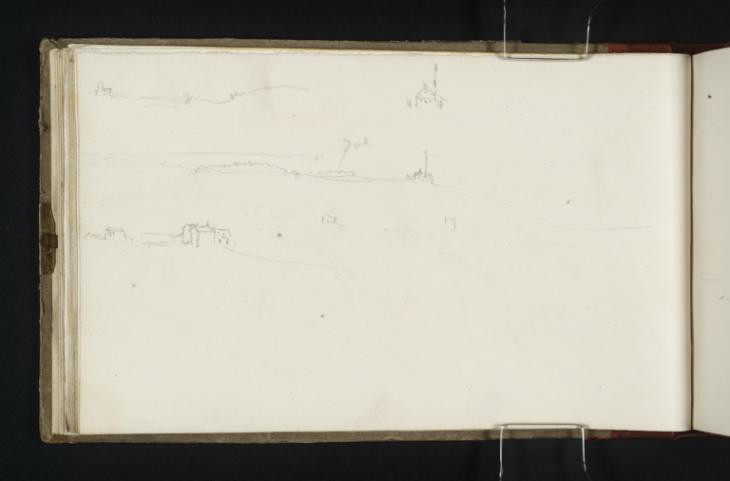
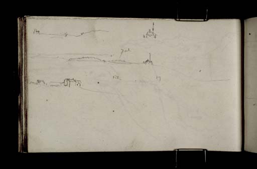
This page demonstrates several coastal perspectives, all viewed from inland and including small architectural landmarks. A lightly rendered line extends the central view across the whole width of the page, whilst the other drawings are more abbreviated. Each of the three landscapes is built on a framework supplied predominantly by a single line. Having established the shape of the coast in every example, Turner elaborates on it, hanging further features of each view from this one, decisive topographical vein. In places, he has also made isolated drawings. Two of these towards the centre of the page are very small and illegible, but at the top a careful study of a cottage is very clear.
Finberg suggests that Turner’s inscription on this page, in reference to the central view, might refer to the Kentish coastal town of Deal.1 The annotation does appear to concur with Finberg’s assertion, and yet the topography of the view does not. A large, smooth curve denoting a coastal bay is demonstrated by a shallow ellipsis beyond the contentiously labelled location. It is possible therefore that there are four main panoramic studies here, and that two of them overlap in such a way as to produce a convincing join.
If Turner’s technique of basing each impression primarily on the scaffolding of a single line is taken as a defining feature of these drawings, then it helps to corroborate the argument that the central prospect might combine two separate locations. The curved section on the left hand side that seems to depict a bay is rendered with a markedly lighter touch than the right hand section. The end of the lower edge of the elliptical arc runs parallel with the darker, harder line of the urban horizon above, and peters out almost directly beneath Turner’s inscription. By comparison, the right hand side of the prospect clearly starts with the unpredictable zigzag denoting a distant town, and carries on across the page in the direction of the gutter on the right, sloping downwards and losing definition. Essentially, then, this view is comprised of two main shapes. Of course, it might be that Turner simply required two basic linear guides in order to convey comprehensively what he observed.
This page appears to continue a series of successive drawings between folios 20 verso and 23 recto made along the cliffs between Folkestone and Dover (D17240, D17241–D17242, D17245).
Maud Whatley
January 2016
How to cite
Maud Whatley, ‘Cliffs on the Kent Coast, Possibly between Folkestone and Dover c.1821–2 by Joseph Mallord William Turner’, catalogue entry, January 2016, in David Blayney Brown (ed.), J.M.W. Turner: Sketchbooks, Drawings and Watercolours, Tate Research Publication, February 2017, https://www


