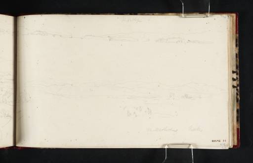
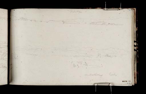
Joseph Mallord William Turner Panorama of the Kent Estuary from Near Milnthorpe 1816
Image 1 of 2
Joseph Mallord William Turner,
Panorama of the Kent Estuary from Near Milnthorpe
1816
Joseph Mallord William Turner 1775–1851
Folio 36 Recto:
Panorama of the Kent Estuary from Near Milnthorpe 1816
D11500
Turner Bequest CXLVII 36
Turner Bequest CXLVII 36
Pencil on white wove paper, 125 x 206 mm
Inscribed by Turner in pencil ‘Milnthorpe S’ top centre, ‘Millnthorpe North’ bottom right and ‘W’ at centre of lower sketch
Inscribed by ?John Ruskin in blue ink ‘279’ bottom right and ‘36’ top right
Stamped in black ‘CXLVII 36’ bottom right
Inscribed by Turner in pencil ‘Milnthorpe S’ top centre, ‘Millnthorpe North’ bottom right and ‘W’ at centre of lower sketch
Inscribed by ?John Ruskin in blue ink ‘279’ bottom right and ‘36’ top right
Stamped in black ‘CXLVII 36’ bottom right
Accepted by the nation as part of the Turner Bequest 1856
References
1909
A.J. Finberg, A Complete Inventory of the Drawings of the Turner Bequest, London 1909, vol.I, p.425, CXLVII 36, as ‘River among hills, with distant view of “Milnthorpe”’.
1984
David Hill, In Turner’s Footsteps: Through the Hills and Dales of Northern England, London 1984, pp.31 as ‘A panorama in two parts, i Milnthorpe s[outh], and ii Milnthorpe North’, 79–80, 127.
This is the first of a sequence of sketches of the shores of Morecambe Bay and its northern margins as far as Ulverston, spread across each of the three sketchbooks, including Yorkshire 2 and Yorkshire 5 (Tate D11042–D11371; D40844–D40845; D41443; Turner Bequest CXLV and Tate D11518–D11595; D40860–D40862; Turner Bequest CXLVIII) that Turner used concurrently on his tour of the north of England in 1816.
Here, Turner records two panoramas of the estuary of the River Kent as seen from the shore about half a mile west of Milnthorpe. Milnthorpe is about five miles south of Kendal, and one and a half miles south of Levens Bridge, the last bridge over the Kent. The main sketch (centre) looks north-west with Whitbarrow Scar in the centre marked by a ‘W’, no doubt to indicate its conspicuous expanse of white limestone. To the left are the high peaks of the Coniston Old Man group and to the right (from left to right) the peaks of Fairfield, Kirkstone Fell and the High Street group, all more than fifteen miles distant. The latter stand above the head of the Kent, the subject of folio 35 recto (D11498). To the right is a squat tower, possibly a lighthouse, and in the foreground on the sands a group of figures is at work, possibly gathering cockles, still an important activity today.
A second sketch, above, continued on folio 35 verso opposite (D11499) records the view south-west across Milnthorpe Sands towards the mouth of the Kent, with Arnside Knott to the left, and the fells above Grange and Lindale towards the right.
The viewpoint is immediately north of Dallam Tower, the subject of a sketch in the Yorkshire 5 sketchbook (Tate D11595–D11529; Turner Bequest CXLVIII 42–6), which records the same material in the distance as the main sketch here. Similar subjects also occur in the Yorkshire 2 sketchbook (Tate D11044, D11043, D41443; Turner Bequest CXLV 2, 1a, inside front cover).
At the far left of the sheet Turner has drawn a clump of trees and a few other pencil lines continuing the sketch of the Crook of Lune on D11499.
David Hill
February 2009
How to cite
David Hill, ‘Panorama of the Kent Estuary from Near Milnthorpe 1816 by Joseph Mallord William Turner’, catalogue entry, February 2009, in David Blayney Brown (ed.), J.M.W. Turner: Sketchbooks, Drawings and Watercolours, Tate Research Publication, December 2013, https://www


