J.M.W. Turner: Sketchbooks, Drawings and Watercolours

ISBN 978-1-84976-386-8

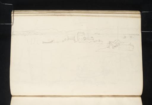
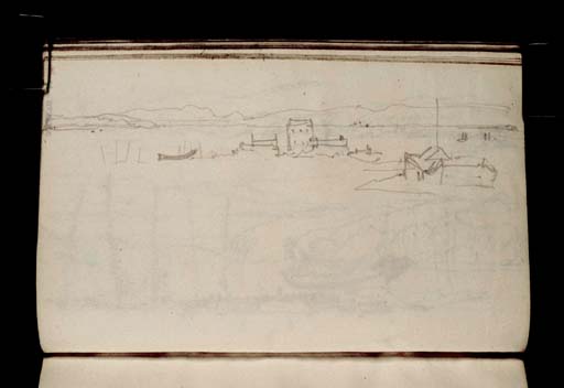
Joseph Mallord William Turner Rosemarkie Peninsular With Fort George in the Distance 1831

Joseph Mallord William Turner 1775–1851
Folio 29 Verso:
Rosemarkie Peninsular With Fort George in the Distance 1831
D27088
Turner Bequest CCLXXVII 29a
Pencil on off-white wove paper, 104 x 163 mm
 
Accepted by the nation as part of the Turner Bequest 1856
Janet Carolan has suggested that this sketch depicts Rosemarkie Peninsula with the Moray Firth in the distance.1 The buildings at the end of the peninsula (actually called Chanonry Point) still look similar today, and Fort George can be seen from this point as it appears at the far right of the sketch. Turner made a number of sketches of Fort George from Rosemarkie and Fort Rose (see folio 12 verso; D27066 for references).

Thomas Ardill
April 2010

1
David Wallace-Hadrill and Janet Carolan, ‘Sketchbook CCLXXVII Inverness’, [circa 1991], Tate catalogue files, [unpaginated].

How to cite

Thomas Ardill, ‘Rosemarkie Peninsular With Fort George in the Distance 1831 by Joseph Mallord William Turner’, catalogue entry, April 2010, in David Blayney Brown (ed.), J.M.W. Turner: Sketchbooks, Drawings and Watercolours, Tate Research Publication, December 2012, https://www.tate.org.uk/art/research-publications/jmw-turner/joseph-mallord-william-turner-rosemarkie-peninsular-with-fort-george-in-the-distance-r1135454, accessed 20 September 2024.