J.M.W. Turner: Sketchbooks, Drawings and Watercolours

ISBN 978-1-84976-386-8

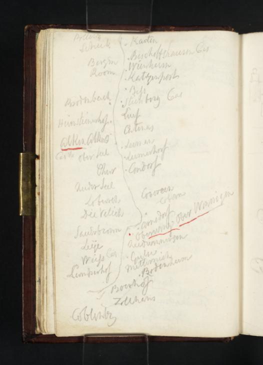
Joseph Mallord William Turner Sketch Map of the Moselle from Burg Bischofstein to Koblenz 1824

Joseph Mallord William Turner 1775–1851
Folio 9 Verso:
Sketch Map of the Moselle from Burg Bischofstein to Koblenz 1824
D19569
Turner Bequest CCXVI 9 a
Pencil and pen and red ink on white wove paper, 118 x 78 mm
Inscribed in pencil and pen and red ink by Turner (see main catalogue entry)
 
Accepted by the nation as part of the Turner Bequest 1856
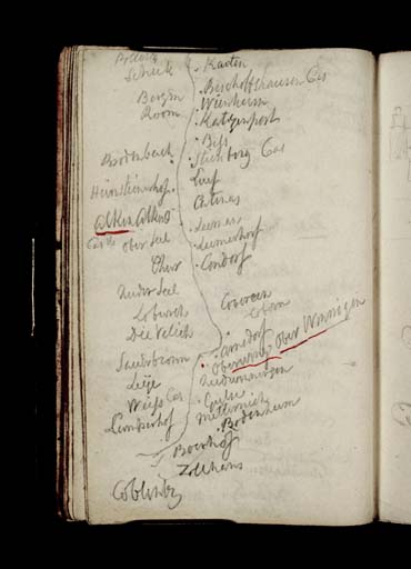
Here Turner has produced a sketch map of the Moselle, beginning at the outskirts of Traben-Trarbach and ending at Müden. The map is a continuation of that on the opposite folio (Tate D19568; Turner Bequest CCXVI 9). The locations that this cataloguer has been able to transcribe are listed below, with an approximation of the real place names noted in brackets to the right of the transcription where necessary or possible. In this map, Turner has underlined Alken and Oberwinnigen in red ink.
From ‘Karten’ (Karden), the towns and villages listed on the map include:
‘Bergen’ (Burgen)
‘Bischoffshausen Cas’ (Bischoftsein Castel)
‘Room’
‘Wierhem’ (possibly Weirschem)
‘Katzenport’ (Hatzenport)
‘Biss’ (possibly referring to the Brißbach, a rivulet)
‘Brodenbach’
‘Steinberg Cas’ (Steinberg and its castle)
‘Luf’ (Löf)
‘H[...]steinhof’
‘Catenas’ (Kattenes)
Alken Alken | Castle’ (Alken and its castle, Burg Thurant)
‘Oberfell’
‘Leeman’ (Lehmen)
‘Lumerhof) (Obere Lehmerhöfe)
‘Gondorf’
‘Nederfell’ (Niederfell)
‘Cobern’ (Kobern)
‘Cocem’ (Concem)
‘Dievilich’ (Dieblich)
‘[?Arnsdorf]’
Oberwing Oberwinnigen
‘Niederwinnigen’
‘Leÿe’ (Lay)
‘Weiss Cas’ (Weiss Castle)
‘Gulse’ (Güls)
‘Metternich’
‘[?Camperhof]’
‘Bodenheim’ (possibly Bubenheim, a district of Koblenz)
‘[?Boerhof]’
‘Zollhaus’ (possibly the German for ‘customs house’)
‘Coblentz’ (Koblenz)

Alice Rylance-Watson
February 2014

How to cite

Alice Rylance-Watson, ‘Sketch Map of the Moselle from Burg Bischofstein to Koblenz 1824 by Joseph Mallord William Turner’, catalogue entry, February 2014, in David Blayney Brown (ed.), J.M.W. Turner: Sketchbooks, Drawings and Watercolours, Tate Research Publication, April 2015, https://www.tate.org.uk/art/research-publications/jmw-turner/joseph-mallord-william-turner-sketch-map-of-the-moselle-from-burg-bischofstein-to-koblenz-r1174357, accessed 18 April 2024.