Joseph Mallord William Turner ?The Hohenstaufen Hill, near Göppingen; Castles and Hills, Probably along the River Rhine 1833
Image 1 of 2
Joseph Mallord William Turner,
?The Hohenstaufen Hill, near Göppingen; Castles and Hills, Probably along the River Rhine
1833
Joseph Mallord William Turner 1775–1851
Folio 15 Recto:
?The Hohenstaufen Hill, near Göppingen; Castles and Hills, Probably along the River Rhine 1833
D32570
Turner Bequest CCCXXII 16
Turner Bequest CCCXXII 16
Pencil on white laid paper, 170 x 105 mm
Inscribed by Turner in pencil ‘[?Gab...]’, ‘Road’ and ‘[?Rhine]’ above centre, and ‘[?Gop...]’ towards bottom centre, upside down
Inscribed by John Ruskin in red ink ‘16’ bottom right
Stamped in black ‘CCCXXII – 16’ bottom right
Inscribed by Turner in pencil ‘[?Gab...]’, ‘Road’ and ‘[?Rhine]’ above centre, and ‘[?Gop...]’ towards bottom centre, upside down
Inscribed by John Ruskin in red ink ‘16’ bottom right
Stamped in black ‘CCCXXII – 16’ bottom right
Accepted by the nation as part of the Turner Bequest 1856
References
1909
A.J. Finberg, A Complete Inventory of the Drawings of the Turner Bequest, London 1909, vol.II, p.1036, CCCXXII 16, as ‘Do. [i.e. ditto: Views beside river] – “Gaberger” (?)’.
1978
Agnes von der Borch, Studien zu Joseph Mallord William Turners Rheinreisen (1817–1844) (Ph.D thesis, Rheinischen Friedrich-Wilhelms-Universität, Bonn 1972), Bonn 1978, p.93, as unspecified Rhine subject.
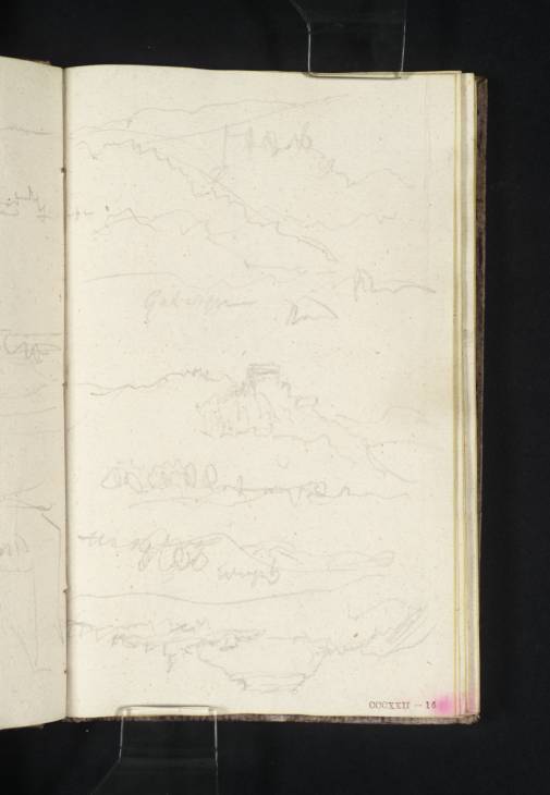
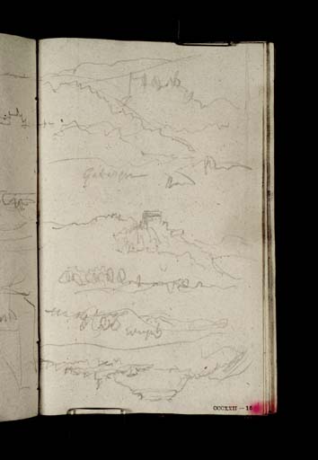
With the vertical page used both ways, there are several overlapping sketches of hills and castles. Finberg tentatively read the scrawled place name above the centre as ‘Gaberger’,1 although little can be made out beyond the first three or four letters. The word to its right appears to be ‘Road’, with what could be ‘Rhine’ to the right again. The hillside castle in the middle view is the most clearly drawn, albeit as yet unidentified.
It is uncertain whether the lower portion of the page comprises one or two views. That at the bottom is certainly inverted, and includes the distinctive profile of what appears to be a flat-topped, conical hill. This could be the Hohenstaufen hill, crowned by a ruined castle north-east of Göppingen, between Ulm and Stuttgart, on Turner’s likely overland route from Augsburg before embarking on the River Rhine. Given his frequent tendency to form the letter ‘p’ as more like an ‘h’, it is just possible that the adjacent note begins ‘Gop’, but all of this is by association with the suggested identification of the full-page view on folio 8 verso (D32557; CCCXXII 9a), under which the possible subject is discussed further.
As set out in its Introduction, this sketchbook covers Turner’s homeward route from Augsburg north-westwards to Rotterdam (see under folios 1 verso and 14 recto respectively; D32543, D32568; CCCXXII 2a, 15). Travelling back down the familiar river, he worked in somewhat randomly from both ends, interspersing identifiable subjects with less distinctive renderings of towns, castles and the landscape.
Matthew Imms
November 2019
How to cite
Matthew Imms, ‘?The Hohenstaufen Hill, near Göppingen; Castles and Hills, Probably along the River Rhine 1833 by Joseph Mallord William Turner’, catalogue entry, November 2019, in David Blayney Brown (ed.), J.M.W. Turner: Sketchbooks, Drawings and Watercolours, Tate Research Publication, March 2023, https://www


