J.M.W. Turner: Sketchbooks, Drawings and Watercolours

ISBN 978-1-84976-386-8

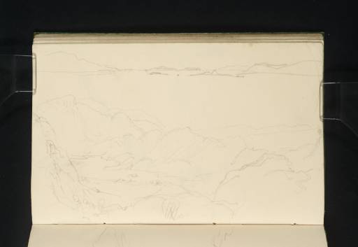
Joseph Mallord William Turner Loch Long from Ben Arthur; and View South from Near Elgol 1831

Joseph Mallord William Turner 1775–1851
Folio 59 Verso:
Loch Long from Ben Arthur; and View South from Near Elgol 1831
D26553
Turner Bequest CCLXX 59a
Pencil on white wove paper, 125 x 201 mm
 
Accepted by the nation as part of the Turner Bequest 1856
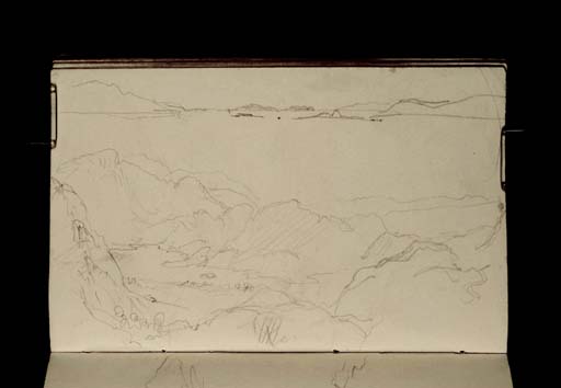
The larger sketch on this page has been identified as the view east from Ben Arthur towards Ben Lomond.1 Turner seems to have ascended the eastern slope of Ben Arthur, and descended by the same route to Loch Long. The ‘mountain pass’ that Finberg refers to in his itinerary is therefore the footpath that Turner followed between Ben Arthur and Beinn Narnain to the shore of Loch Long.2 Between the shoulders of the two mountains we look east over Loch Long with the peak of Ben Lomond at the left. Turner made further sketches from Ben Arthur on folios 33 and 58 verso–61 (D26500, D26552–D26556).
Across the top of the page is a sketch of the mouth of a river or sea loch with islands. This may be a view from near Elgol on Skye, which looks south across Loch Scavaig towards the sea with the islands of Soay, Rum and Eigg. See folio 70 (D26574) for a similar view.

Thomas Ardill
November 2009

1
David Wallace-Hadrill and Janet Carolan, ‘Turner Round the Clyde and in Islay – 1831’, 1991, Tate catalogue files, folio 4.
2
Finberg 1909, II, p.870.

How to cite

Thomas Ardill, ‘Loch Long from Ben Arthur; and View South from Near Elgol 1831 by Joseph Mallord William Turner’, catalogue entry, November 2009, in David Blayney Brown (ed.), J.M.W. Turner: Sketchbooks, Drawings and Watercolours, Tate Research Publication, December 2012, https://www.tate.org.uk/art/research-publications/jmw-turner/joseph-mallord-william-turner-loch-long-from-ben-arthur-and-view-south-from-near-elgol-r1134987, accessed 19 September 2024.