J.M.W. Turner
>
1830-35 Annual tourist
>
Scotland 1831
>
Staffa Sketchbook
>
Artwork
Joseph Mallord William Turner Sketches of Fort William; and a Sketch of the Isle of Staffa 1831
Image 1 of 2
Joseph Mallord William Turner,
Sketches of Fort William; and a Sketch of the Isle of Staffa
1831
Joseph Mallord William Turner 1775–1851
Folio 8 Verso:
Sketches of Fort William; and a Sketch of the Isle of Staffa 1831
D26760
Turner Bequest CCLXXIII 8a
Turner Bequest CCLXXIII 8a
Pencil on white wove paper, 186 x 116 mm
Accepted by the nation as part of the Turner Bequest 1856
References
1909
A.J. Finberg, A Complete Inventory of the Drawings of the Turner Bequest, London 1909, vol.II, p.875, CCLXXIII 8a, as ‘A cave, and views from the loch.’.
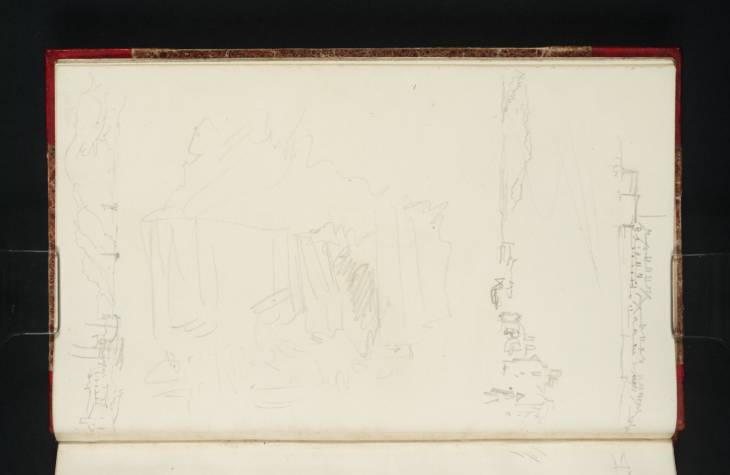
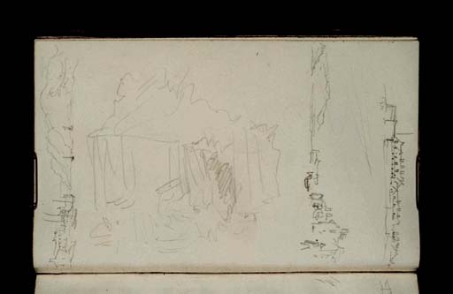
The first sketch that Turner drew on this page was the largest sketch, drawn with the fore-edge of the page at the top. It has been identified by David Wallace-Hadrill and Janet Carolan, along with two sketches on folio 9 (D26761), as likely to be of the Isle of Staffa.1 Their suggestion is presumably based on the distinctive vertical striations on the rock face which match Turner’s depiction of basalt columns in other sketches of the island (see folio 40; D26817 for full references). A shaded area just to the right of the centre of the rock may mark a cave entrance which is likely to be Fingal’s Cave, as depicted on folio 20 verso (D26781).
The other three sketches on the page are of Fort William. Turner stopped at Fort William during his journey from Oban to Inverness via Loch Linnhe and the Caledonian Canal. The entrance to the canal is at Corpach just to the north of Fort William, so Turner probably changed boats at the town and perhaps stayed the night. While there he made just a few sketches of the town, especially around the area of the old fort (now the site of the railway station and sidings): folios 8 verso and 12 verso–14 (D26767–D26770). This left the Staffa sketchbook almost full, and so Turner opened his next sketchbook, the Fort Augustus sketchbook, and filled a few pages at the front of that book with sketches made around the foothills of Ben Nevis (Tate D26967, D26968, D26969; Turner Bequest CCLXXVI 2, 3, 4).
The two sketches at the top of the present page have been identified as the old fort from the south.2 The top sketch looks across Loch Linnhe from the shore to the south, to the walls of the fort. The sketch continues at the right on folio 9 (D26761), where the entrance archway to the fort is shown (this was moved to a cemetery nearby after the building of the West Highland Railway). The sketch beneath may show some of the same buildings that are visible in the top sketch, but now from closer and with the shore of Loch Linnhe around Corpach to the left. Drawn at the bottom of the page with the sketchbook inverted is another view of Fort William, this time from the north-east with the hills on the western shore of the Loch opposite at the right. This sketch includes boats moored at the pier and sailing up Loch Linnhe. The dark boat with no sail in the Loch may be a steamboat of the type that Turner took up the Caledonian Canal from Fort William to Inverness.
Thomas Ardill
April 2010
How to cite
Thomas Ardill, ‘Sketches of Fort William; and a Sketch of the Isle of Staffa 1831 by Joseph Mallord William Turner’, catalogue entry, April 2010, in David Blayney Brown (ed.), J.M.W. Turner: Sketchbooks, Drawings and Watercolours, Tate Research Publication, December 2012, https://www


