J.M.W. Turner
>
1830-35 Annual tourist
>
Scotland 1831
>
Inverness Sketchbook
>
Artwork
Joseph Mallord William Turner The Moray Firth with Fort George from the West; and Two Other Sketches 1831
Image 1 of 2
Joseph Mallord William Turner,
The Moray Firth with Fort George from the West; and Two Other Sketches
1831
Joseph Mallord William Turner 1775–1851
Folio 6 Recto:
The Moray Firth with Fort George from the West; and Two Other Sketches 1831
D27054
Turner Bequest CCLXXVII 6
Turner Bequest CCLXXVII 6
Pencil on off-white wove paper, 104 x 163 mm
Inscribed in pencil by Turner [illegible] centre, and ‘Kill[...]’ lower centre inverted
Inscribed in red ink by John Ruskin ‘6’ bottom left descending vertically
Stamped in black ‘CCLXXVII 6’ bottom left descending
Inscribed in pencil by Turner [illegible] centre, and ‘Kill[...]’ lower centre inverted
Inscribed in red ink by John Ruskin ‘6’ bottom left descending vertically
Stamped in black ‘CCLXXVII 6’ bottom left descending
Accepted by the nation as part of the Turner Bequest 1856
References
1909
A.J. Finberg, A Complete Inventory of the Drawings of the Turner Bequest, London 1909, vol.II, p.882, CCLXXVII 6, as ‘Mountains. “Kill...” (Killravock.)’.
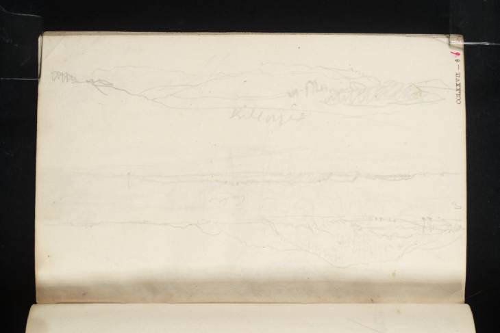
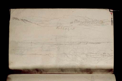
At the top of this page, drawn towards the page gutter, is a sketch that David Wallace-Hadrill and Janet Carolan have identified as a view north-east up the Moray Firth, from the mouth of the River Ness near Inverness. On his copy of the sketch, Wallace-Hadrill labelled Kessock Ferry at the left, Ord Hill at the centre, Rosemarkie and Chanonry Point towards the right and Fort George at the far right.1 Therefore this is Turner’s first sketch looking towards Fort George, the mid-eighteenth-century fortress built on a promontory eleven miles north-east of Inverness. Turner made further views of the fort from the Black Isle, especially around Rosemarkie and Fort Rose, and from the southern shore of the Moray Firth around Ardersier: folios 10, 12 verso, 13, 29, 29 verso, 31 verso, 32, 32 verso, 62 (D27062, D27066, D27067, D27087, D27088, D27091, D27092, D27093, D27126).
At the centre of the page is a sketch of an island or shore seen from across the water. The sketch is inscribed, though illegibly. Wallace-Hadrill and Carolan have suggested that this may be the Fort George peninsula, which is certainly plausible, though without the fort clearly visible this identification is uncertain.
At the bottom of the page, drawn with the book inverted, is a sketch that seems to show a tower in a landscape. Finberg read Turner’s inscription as ‘Killravock’,2 referring to the Tower House near the village of Croy, which lies just off the road from Inverness to Elgin. Turner would have passed nearby on his journey to Elgin, but the sketch is inconclusive about the architecture and setting of the castle. David Wallace-Hadrill suggested instead that this could be Balnagown Castle near Kildary north of Cromarty Bay, but there is little evidence and no apparent reason for Turner to have gone that way. Janet Carolan suggested this could be Novar House from the Cromarty Firth as in a loose-leaf sketch that the authors identified as showing the estate (Tate D34797; Turner Bequest CCCXLIV d 330).3 The building, however, appears to be too small for Novar House. This range of suggestions demonstrates the ambiguity of this rapidly executed sketch.
Thomas Ardill
April 2010
How to cite
Thomas Ardill, ‘The Moray Firth with Fort George from the West; and Two Other Sketches 1831 by Joseph Mallord William Turner’, catalogue entry, April 2010, in David Blayney Brown (ed.), J.M.W. Turner: Sketchbooks, Drawings and Watercolours, Tate Research Publication, December 2012, https://www


