J.M.W. Turner: Sketchbooks, Drawings and Watercolours

ISBN 978-1-84976-386-8

Joseph Mallord William Turner Inverness and Beauly Firth from North Kessock 1831

Joseph Mallord William Turner 1775–1851
Folio 9 Verso:
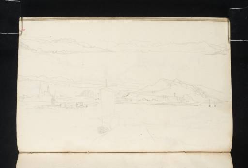
Inverness and Beauly Firth from North Kessock 1831
D27061
Turner Bequest CCLXXVII 9a
Pencil on off-white wove paper, 104 x 163 mm
 
Accepted by the nation as part of the Turner Bequest 1856
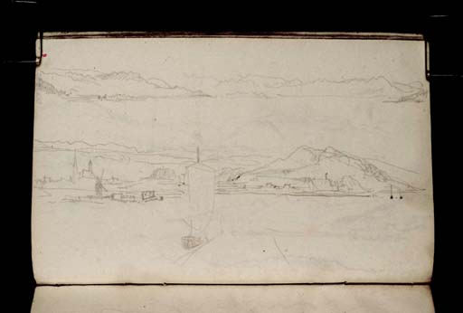
Across the bottom half of this page is a view identified as Inverness from North Kessock.1 Two distinctive features of the town are the spires of the Tollbooth and the Old High Church at the left. Just to the right is Tomnahurich Hill, and at the right of the sketch is the much larger hill of Craig Phadrig, the site of a Pictish fort. There is a windmill at the mouth of the River Ness below the towers, and in the distance are the hills that surround Loch Ness. In the foreground is a trapezium shape denoting a small jetty from which a small boat with a large sail has just departed. Turner is likely to have made this sketch immediately after landing at North Kessock on the Black Isle (actually a peninsula), having crossed the Moray Firth from Inverness. From here Turner made his way north to Evanton via Dingwall.
The other sketch drawn across the top of this page is likely to have been made from the same spot and may be a view west up Beauly Firth.2

Thomas Ardill
April 2010

1
David Wallace-Hadrill and Janet Carolan, ‘Sketchbook CCLXXVII Inverness’, [circa 1991], Tate catalogue files, [unpaginated].
2
Ibid.

How to cite

Thomas Ardill, ‘Inverness and Beauly Firth from North Kessock 1831 by Joseph Mallord William Turner’, catalogue entry, April 2010, in David Blayney Brown (ed.), J.M.W. Turner: Sketchbooks, Drawings and Watercolours, Tate Research Publication, December 2012, https://www.tate.org.uk/art/research-publications/jmw-turner/joseph-mallord-william-turner-inverness-and-beauly-firth-from-north-kessock-r1135427, accessed 25 April 2024.