J.M.W. Turner: Sketchbooks, Drawings and Watercolours

ISBN 978-1-84976-386-8

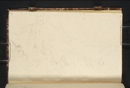
Joseph Mallord William Turner Burg Gutenfels, Kaub and the Pfalz Looking Upstream 1839

Joseph Mallord William Turner 1775–1851
Folio 75 Recto:
Burg Gutenfels, Kaub and the Pfalz Looking Upstream 1839
D28499
Turner Bequest CCXC 75
Pencil on flecked off-white wove paper, 100 x 163 mm
Inscribed in blue ink by Ruskin ‘75’ top right
Stamped in black ‘CCXC–75’ bottom right
 
Accepted by the nation as part of the Turner Bequest 1856
This slight sketch shows the town of Kaub, situated between Oberwesel and Bachrach on the right bank of the Rhine. The view encompasses the twelfth-century Burg Gutenfels (also known as Castle Caub) atop the cliff at left, the evangelical rectory and spired Catholic church below, and the Pfalzgrafenstein, a toll castle on Falkenau island in the Rhine, at right. The Pfalz was erected in the fourteenth century to collect levys from ships passing through this stretch of the river for Castle Gutenfels.1

Alice Rylance-Watson
July 2013

1
‘Geschichte’, Burg Pfalzgrafenstein, http://www.burg-pfalzgrafenstein.de/geschichte, accessed 30 July 2013.

How to cite

Alice Rylance-Watson, ‘Burg Gutenfels, Kaub and the Pfalz Looking Upstream 1839 by Joseph Mallord William Turner’, catalogue entry, July 2013, in David Blayney Brown (ed.), J.M.W. Turner: Sketchbooks, Drawings and Watercolours, Tate Research Publication, November 2014, https://www.tate.org.uk/art/research-publications/jmw-turner/joseph-mallord-william-turner-burg-gutenfels-kaub-and-the-pfalz-looking-upstream-r1150782, accessed 26 April 2024.