J.M.W. Turner: Sketchbooks, Drawings and Watercolours

ISBN 978-1-84976-386-8

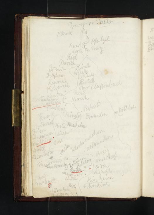
Joseph Mallord William Turner Sketch Map of Moselle between Trier (Trèves) and Traben-Trarbach 1824

Joseph Mallord William Turner 1775–1851
Folio 8 Verso:
Sketch Map of Moselle between Trier (Trèves) and Traben-Trarbach 1824
D19567
Turner Bequest CCXVI 8 a
Pencil and pen and red ink on white wove paper, 118 x 78 mm
Inscribed in pencil and pen and red ink by Turner (see main catalogue entry)
 
Accepted by the nation as part of the Turner Bequest 1856
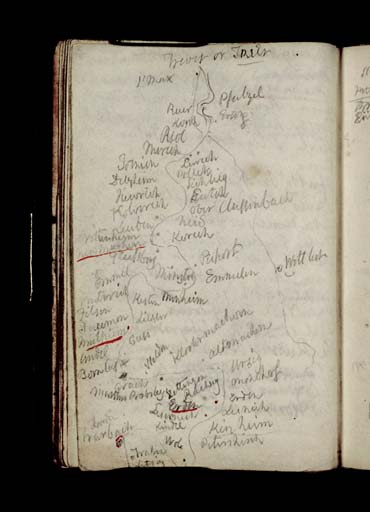
Here Turner has produced a sketch map of the Moselle between the ancient Roman city of Trier and the Traben-Trarbach in Germany. The map is continued on the opposite folio (Tate D19568; Turner Bequest CCXVI 9). The locations that this cataloguer has been able to transcribe are listed below, with an approximation of the real place names noted in brackets to the right of the transcription where necessary or possible.
From ‘Treves or Trier’ the towns and villages listed on the map include:
‘St Max’ (presumably referring to the church of St Maximin in Trier)
‘Pfalzel’ (Pfälzel)
‘Erag’ (Erang)
‘Ruer’
‘Kerch’ (possibly ‘Kirche’, the German for church)
‘Riol’
‘Merich’ (Mehring)
‘Tornich’ (Thörnich)
‘Delzheim’ (Detzem)
‘Pollik’ (Pölich)
‘Sichlig’ (Schleich)
‘Entch’ (Ensch)
‘Ober Clussenbach’ (Klüsserath)
‘Kolwerch’ (Köwerich)
‘Leuben’ (Leiwen)
‘Trittenheim’
‘Newmagen’ (Neumagen)
‘Pisport’ (Piesport)
‘Emmel’ and ‘Emmelen’ (Niederemmel)
‘Minheim’
‘Vinterich’ (Wintrich)
‘Kesten’
‘Lieser’ (Leiser)
Mulheim’ (Mülheim)
‘?Guss’ (?Kueser Plateau)
‘Andel’
‘Bornkas’ (Bernkastel)
‘Grach’ (Graach)
‘Welden’ (Wehlen)
‘Kloster[...]’
‘Alternach[...]’
‘Zeltingen | Rachtig’
‘Urzig’ (Ürzig)
‘Banhof’ (Ürzig Bahnhof)
Erden
‘Lisnich’ (Lösnich)
‘Kindle’ (Kindel)
‘Kinheim’
‘Wole’ (Wolf)
‘Traben’
‘Trarbach’

Alice Rylance-Watson
February 2014

How to cite

Alice Rylance-Watson, ‘Sketch Map of Moselle between Trier (Trèves) and Traben-Trarbach 1824 by Joseph Mallord William Turner’, catalogue entry, February 2014, in David Blayney Brown (ed.), J.M.W. Turner: Sketchbooks, Drawings and Watercolours, Tate Research Publication, April 2015, https://www.tate.org.uk/art/research-publications/jmw-turner/joseph-mallord-william-turner-sketch-map-of-moselle-between-trier-treves-and-traben-r1174355, accessed 25 April 2024.