
J.M.W. Turner: Sketchbooks, Drawings and Watercolours

ISBN 978-1-84976-386-8

Joseph Mallord William Turner Three Views of the ?River Paillon, Nice; Part of a Map of the South of France 1838
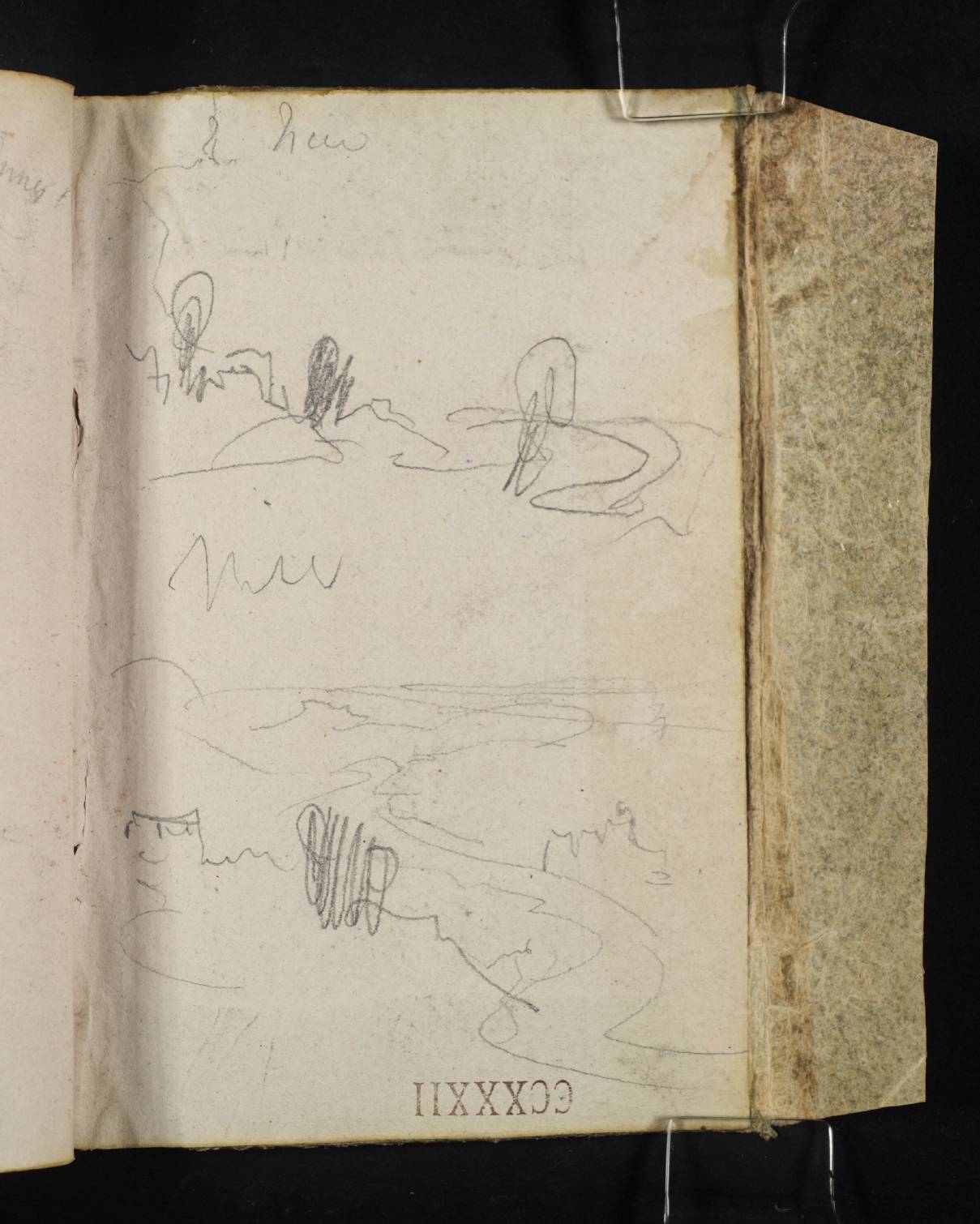
Inside Front Cover:
Three Views of the ?River Paillon, Nice; Part of a Map of the South of France 1838
D41043
Pencil on white wove paper, 157 x 98 mm
Inscribed in pencil by Turner ‘Nice’ top centre left, and ‘Nice’ centre left
Stamped in black ‘CCXXXII’ bottom centre, upside down
 
Accepted by the nation as part of the Turner Bequest 1856
Turner has used the inside front cover of the sketchbook to make three rough landscape sketches, executed with the book inverted in relation to its foliation. As Turner’s inscriptions indicate, the subject of the drawings is ‘Nice’, a prominent city on France’s Mediterranean coastline. Situated at the foot of the French Alps, the city was part of the Kingdom of Piedmont-Sardinia at the time of Turner’s visit. It marks the approximate half-way point of the journey described in this sketchbook, which begins in Toulon and ends in Genoa (for a detailed overview of Turner’s itinerary, see the Introduction).
The design in the bottom left-hand corner (distinguished by a bolder pencil line) appears to be partially superimposed over the adjacent drawing. The vistas are too schematic to be conclusively identified, although geographer and Turner researcher Roland Courtot has suggested the views may have been drawn from the slopes of Mont Alban looking towards the bay of Anges.1 The compositions appear to incorporate the meandering course of a river, presumably the River Paillon, which once flowed through the centre of the city. The Paillon would have been a prominent feature in Nice at the time of Turner’s visit, before being culverted at the end of the nineteenth century. Today, a newly installed park area, the Promenade du Paillon, mimics the original course and expanse of the river in the city centre.
There are many drawings of Nice in this sketchbook (see, for example, folios 5 verso, 6 recto, 48 verso and 62 verso; D21280, D21281, D21355, D21383), including an extensive, discrete sequence of views recorded on pages towards the end of the foliation (see folios 54 verso–59 verso; D21367–D21377).
The details in the top left-hand corner of the sheet represent part of a rough sketch of a map of the South of France, which has extended from folio 1 recto opposite (D21271). As Turner’s handwritten label indicates, this part of the map includes the coastline of ‘Nice’, whilst on the opposite leaf can be found ‘Frejus’ [sic] and ‘Cannes’.

Nicola Moorby
May 2017

Revised by Hayley Flynn
June 2025

1
Roland Courtot, ‘Carnet de voyage de Turner: 9. Notebook CCXXXII “Côte de Génès” (1838?)’, Hypotheses, 24 August 2018, accessed 24 June 2024, https://carnetswt.hypotheses.org/949.

How to cite

Nicola Moorby, ‘Three Views of the ?River Paillon, Nice; Part of a Map of the South of France 1838’, catalogue entry, May 2017, revised by Hayley Flynn, June 2025, in David Blayney Brown (ed.), J.M.W. Turner: Sketchbooks, Drawings and Watercolours, Tate Research Publication, July 2026, https://www.tate.org.uk/art/research-publications/jmw-turner/three-views-of-the-river-paillon-nice-part-of-a-map-of-the-south-of-france-r1213447, accessed 17 September 2026.