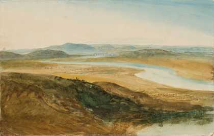
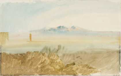
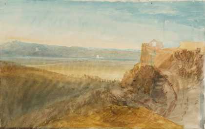
You might like Left Right View of Tivoli, from the Valley of the River Aniene Joseph Mallord William Turner 1819 View of the Valley of the River Aniene, Tivoli Joseph Mallord William Turner 1819 The Roman Campagna with the River Tiber and Ponte Molle in the Distance Joseph Mallord William Turner 1819 The Roman Campagna and the River Tiber, looking Upstream from the Fontana dell’Acqua Acetosa Joseph Mallord William Turner 1819 The River Aniene with the Ponte Salario and Torre Salaria, Rome Joseph Mallord William Turner 1819 The River Aniene with the Ponte Salario and Torre Salaria, Rome Joseph Mallord William Turner 1819 The Roman Campagna with Monte Gennaro in the Distance Joseph Mallord William Turner 1819 The Roman Campagna with Ponte Molle in the Distance Joseph Mallord William Turner 1819 The Roman Campagna from Monte Parioli, with the River Tiber and the Torre Lazzaroni Joseph Mallord William Turner 1819 The Roman Campagna from Monte Parioli, with the River Tiber and the Torre Lazzaroni Joseph Mallord William Turner 1819 The Confluence of the Tiber and Aniene Rivers with the Torre Salaria, Rome Joseph Mallord William Turner 1819 Two Sketches of the River Aniene near Rome; One with Ponte Nomentano Joseph Mallord William Turner 1819